IOTA ashore causing fatal mudslides and flooding
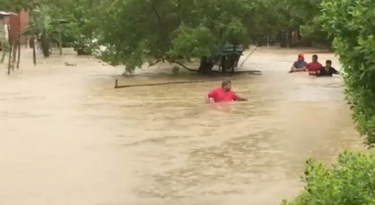
Hurricane IOTA finally made landfall overnight, with a last gasp slight acceleration and whiff of dry air entering the convection column causing an eleventh hour rise in pressure, albeit modest in absolute terms and of little consolation to coastal inhabitants. IOTA still came ashore as a powerful category four storm, just 12 miles south of the position where category four hurricane ETA made landfall exactly two weeks ago. At the time the eye crossed the coast, IOTA had a hurricane severity index rating of 25 (8 for size and 17 for intensity) producing a sustained wind speed of 135 gusting 145 knots. There are already reports of catastrophic flooding and fatal mudslides. Although IOTA is expected to weaken quickly, heavy rainfall will remain the greatest threat across Central America with some of the heaviest expected in areas that were flooded by ETA. Peak accumulations could approach 20 inches over the northern part of Honduras resulting in more severe to catastrophic flooding and widespread mudslides. It is expected that IOTA will dissipate over southern Honduras and El Salvador early tomorrow.
There are signs of pressure gradients lining up to form a new low tomorrow in the far south-west Caribbean north of Panama. Environmental conditions are expected to be favourable for this to develop into a tropical depression or tropical storm by Friday as it heads west-sou’west. As things stand, modellers have this moving harmlessly ashore into southern Nicaragua or Costa Rica by the end of the week. Given the ferocity of this season, I would be reluctant to use the word ‘harmlessly’ in any forecast over 24 hours ahead.
Stand by for tropical storm force winds in the north-western Caribbean in the wake of hurricane IOTA.
Image courtesy Reuters