IDA prompts first ever National Weather Service flash-flood emergency warning for New York
From west to east;
Disturbance Thirty Eight is still loafing around in the far south-western Caribbean, expected to move slowly west-nor’west across the mountainous terrain of Central America and southern Mexico. No development would take place during this period due to land interaction and unfavourable atmospheric conditions but this may have legs when it reaches the Bay of Campeche early next week. Conditions in the Gulf of Mexico remain favourable for development, albeit highly speculative this far ahead, however this will as a very minimum produce increased showers and thunderstorms spreading north over the western and northwest Gulf by the middle of next week.
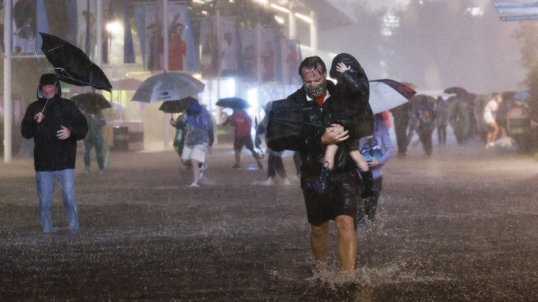
Whilst IDA is off our marine radar, the remnants of the storm have caused considerable flooding with New York City suffering its wettest hour on record earlier today. The system itself is expected to be absorbed by a dominant front later today, but with the worst excesses being east of the nominal centre, more heavy rainfall is expected over New Jersey and Connecticut later.
LARRY reached hurricane intensity overnight and with the latest aerial imagery showing another burst of thunderstorms near the eye, a further increase in intensity is on the cards. I have always had this down as a category five however the more reliable commentators are more cautious. Currently 520 miles west-sou’west of the Cape Verde Islands and moving west at 16 knots, LARRY has a hurricane severity index rating of 8 (3 for size and 5 for intensity) based on 75 knot winds over a 80 mile radius with a predicted peak of 28 (13 for size and 15 for intensity). The cyclone’s track has, up to now been one that has turned north early and cleared all land areas but there has been a shift in opinion overnight and the consensus takes this slightly closer to Bermuda. Historically the more powerful storms in this area tend to move further west before turning north, so ‘slightly closer to Bermuda’ may become less slight if LARRY hits the big time.
Stand by for more heavy rainfall ashore in the north-east continental United States and a watch needed in the east central Atlantic, otherwise stand easy.
Image Larry David Paciotti